RobT: I have really been looking forward to seeing the famous red dunes of the Namib Desert in Namibia. We got an early start, as we were hoping to reach Sesriem before nightfall, so we could watch the sun setting over the red dunes. Well, at least that was the plan. Another 500 km (325 mile) day, the first 200 km on nice paved road to Mariental, but we barely got out of Keetmanshoop when we came across several makeshift huts along the road. The huts were made of sticks and boards and plastic sheeting, but inside they housed a variety of crafts and native artifacts. The peoples seemed to be from elsewhere, as we did not recognize their language and the kids were not going to school.
Native African carvings.
Some very nice crafts rom all over southern Africa.
Dickering over a walking stick.
Another 100 km of pavement west to the small settlement of Maltahöhe. Not much in this little town. We debated about getting fuel again, as we didn’t know what to expect in Sesriem at the red dunes. We thought we would be fine. The gravel road started just outside of town and it was looking good for getting to Sesriem by 3 pm. Plenty of time to get oriented and get to the dunes for the sunset. We were clipping along nicely on Road C19 without a care in the world, not looking at the GPS, as there didn’t seem to be any major side roads and no signs at these roads indicating Sesriem.
60 km later I looked at the GPS and was startled to find it was telling me to make a U turn!! What!? We stopped, pulled out the maps and tried to figure out where we went wrong. Upon a closer look at the map and verifying it with the GPS we noticed we missed the (unmarked) side road to Sesriem about 50 km back. To add to the problem, we couldn’t go back, correct our mistake and make it there on the fuel we had left. We could continue the wrong way, south to Helmeringhausen, get fuel there an then ride north and west on a different road to Sesriem, but that was 200 km from where we were. That road also looked like a secondary road, which may or may not have been in good condition. We turned back toward the town of Maltahöhe for fuel, which was 20 km past our missed turn off. Sigh.
We made sure we located the road as we passed it. In fact, spoke to a local Bushmen family at the crossroads. They indicated that that was indeed the road we were looking for and after several minutes of difficult conversation due to the language barrier, we also verified that we indeed needed to head back to Maltahöhe for fuel. This was an incredible experience, as these were indigenous Bushmen with their donkeys tethered to a cart waiting at the crossroads for someone or something. We regret not having a picture of this scene.
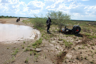
All eyes were on us as we got fuel. We seemed to be a novelty in this town. We headed back out a little dejected due to the lapse in our navigation. We were able to travel along at about a 100 kph on Road C19, a very nice gravel road, until we started to encounter mud holes left behind by yesterday's rains. The first few we could ride around, but we got to one large water crossing on the road, we stopped and thought we might have to turn back. There seemed to be no way around or through this big patch of water and mud that covered the entire road from side to side. Valient (Ed. or stupid) RobC tried the left side, but found the soil under the water to be extremely slipper. He lost control and down he went into the water and mud. After a half hour of lifting the bike out of the mire, fixing the pannier right there in the middle of the mud hole with a big rock, he was returned to terra firma. We studied the area some more and found a way around along the edge of the mud hole to the right, just skirting a nasty thorn bush. RobC made it by partially driving through the water. In the meantime, I had found another route on the other side of the bush, which seemed okay, but the first part was a little tricky. Over the intercom RobC said his route was good. For some unknown reason that only God might understand, I decided to try the route I had found through some mud tracks and as soon as I hit the tricky section my front tire slid out from under me and I landed in the mud beside the nasty thorn bush. RobC turned around and headed back to help me out. By this time there was no way we were seeing the sunset over the dunes. Several more of these treacherous mud and water holes and we were clear, but not without some occasional adrenaline rushes.
First RobC .....
... then yours truly.
We drove through some more arid, dry desert and suddenly we found ourselves in a lush valley of various shades of green which was a stunning contrast to the red dirt/gravel road we had been on for hours. Amazing! The first bit of truly beautiful scenery.
As we emerged from the valley we noticed a huge storm brewing behind us. Thinking it was heading south and we were going west, we didn’t pay much attention to it until we started to feel rain drops, we looked back again and found it was actually following us right on our heels. We could no longer see the mountains behind us due to the heavy rains, but we managed to make it to Sesriem without getting drenched. We checked into the National Park and set up camp. What an amazing campsite!! Every camp site had a stone wall surrounding a tree and a fire pit. Showers, washrooms and a bar/restaurant set in a building with wood floors and a (straw) thatched roof. We also reserved our 4x4 shuttle for the 65 km drive into the dunes the next day. Unfortunately, motorcycles were banned due to some unruly bikers who last year disrespected the posted signs indicating no off-road driving.
These yellow desert flowers were everywhere on the banks of the road.
Close-up of the flowers
Incredible lush, green valley. A stark contrast to the last few days.
The scenery changed drastically as we approached Sesriem.
Our camp for the night.


Oh, my, what beautiful scenery~ And you just had to get muddy falling! No pictures of that I notice. I know you were not laughing, so I'll try hard not to laugh too. :) Cool that you are camping some now under the African stars. Phyllis
ReplyDelete